


The History List
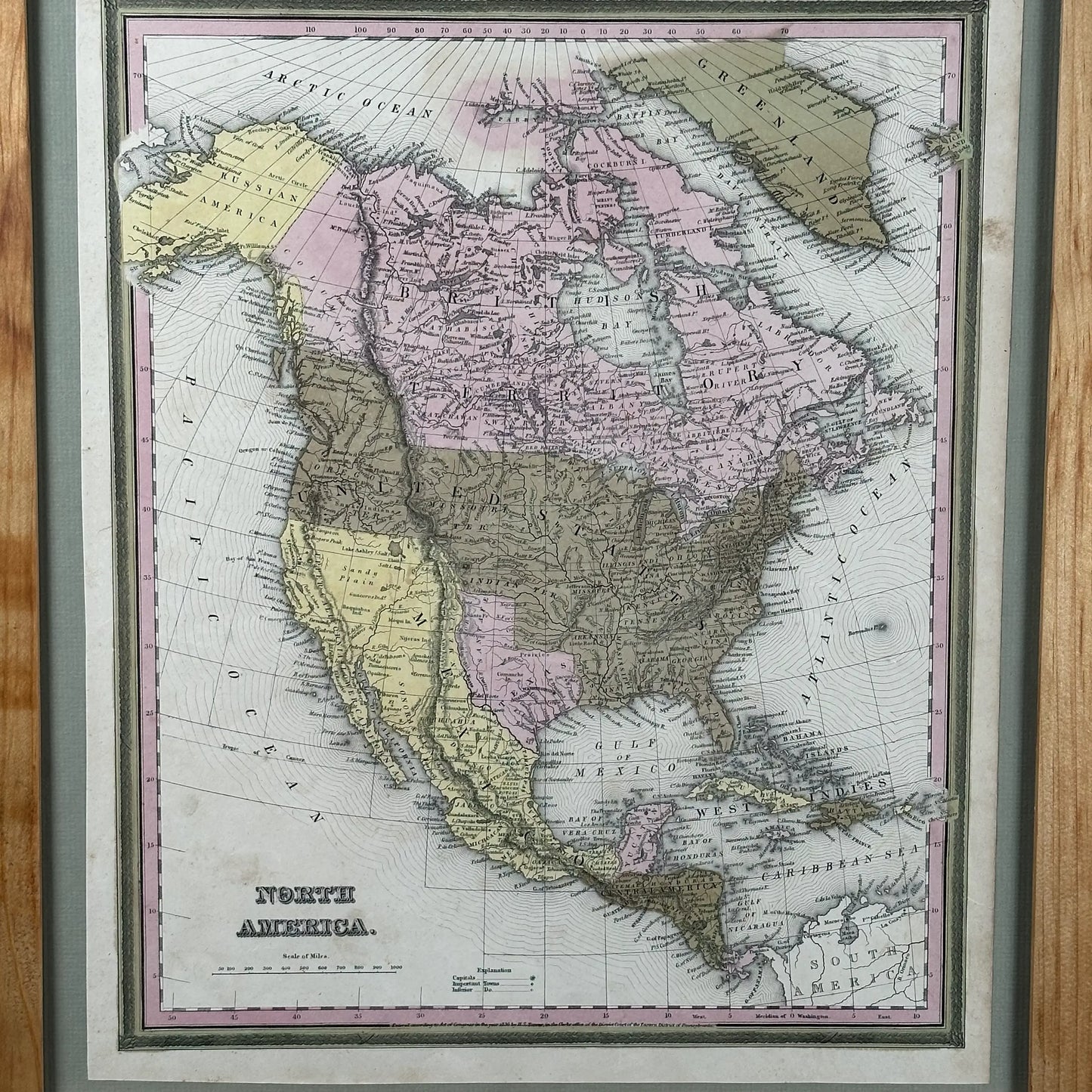
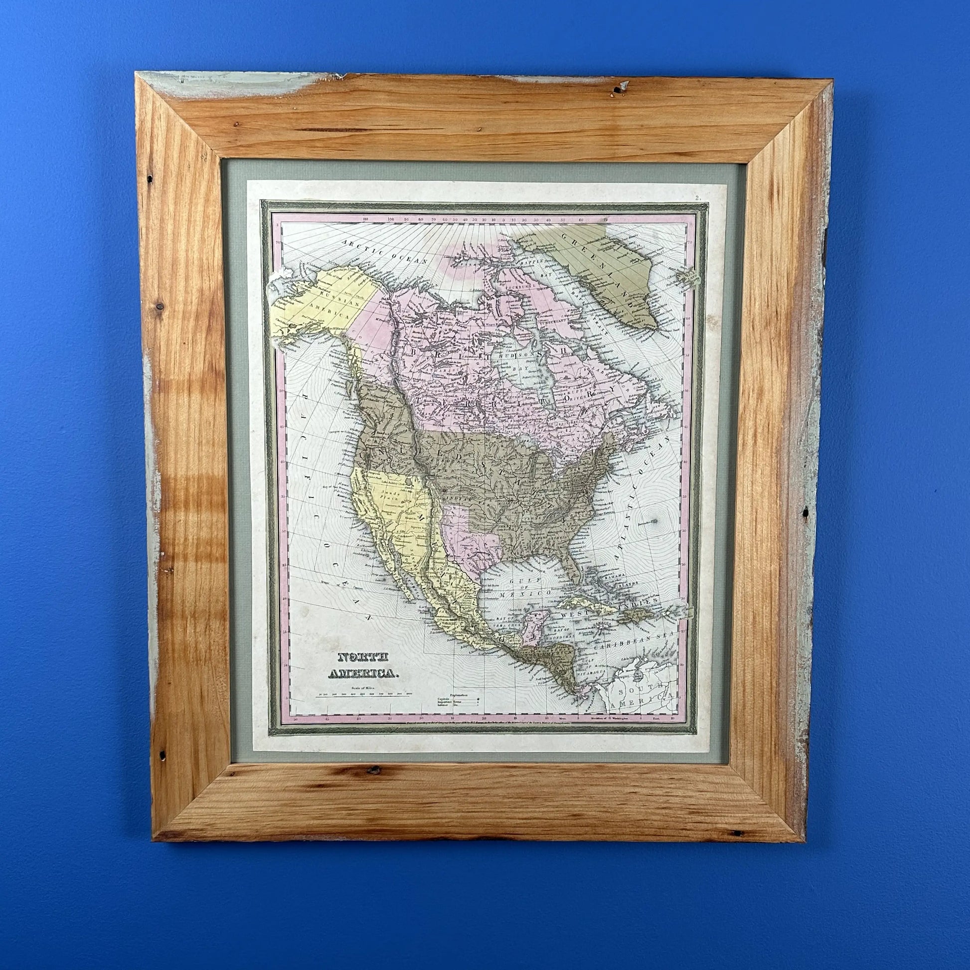
Hand-colored 1836 Map of North America—The year Texas declared independence
$1,495.00
Couldn't load pickup availability
I found this engraved, hand-colored 1836 map—the year Texas declared independence—on the West Coast.
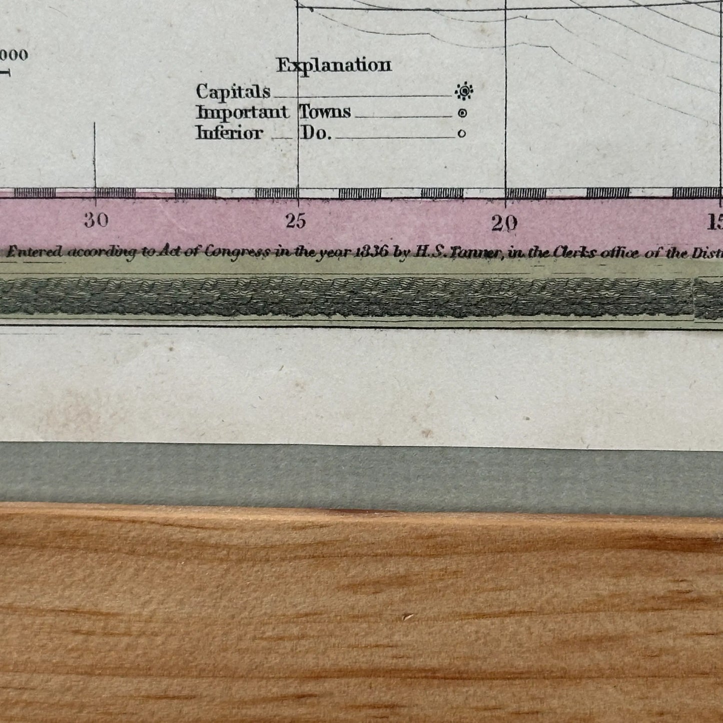
It is from A New Universal Atlas Containing Maps of the various Empires, Kingdoms, States and Republics Of The World. With a special map of each of the United States, Plans of Cities &c. Comprehended in seventy sheets and forming a series of One Hundred And Seventeen Maps, Plans And Sections.
This is an original, not a reproduction.
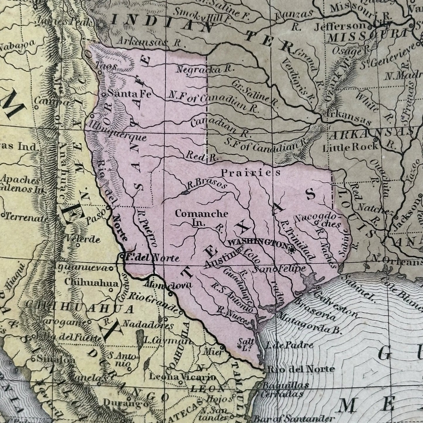
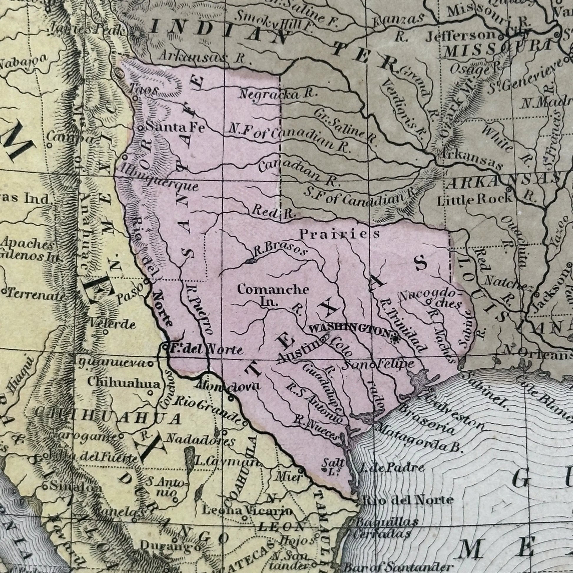
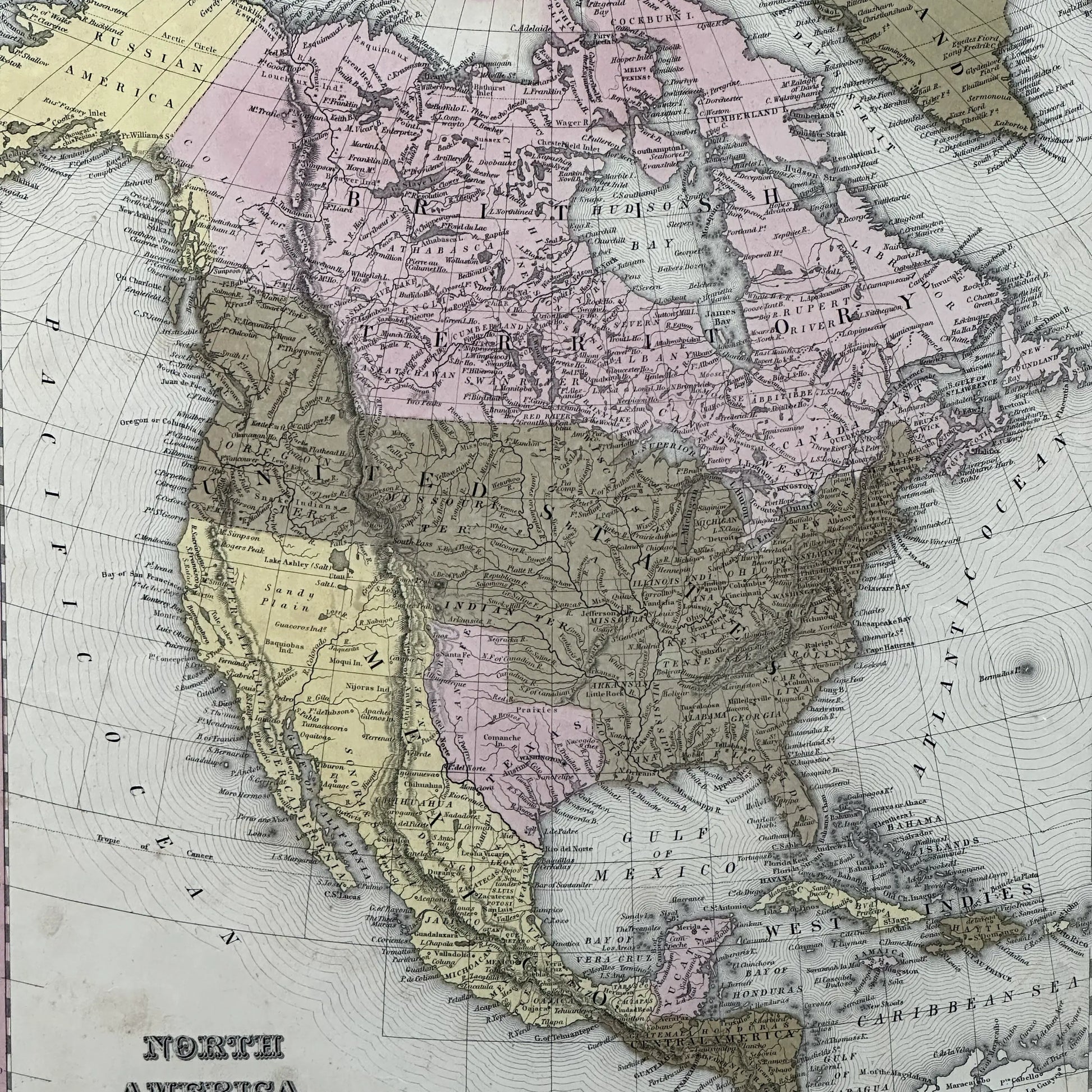
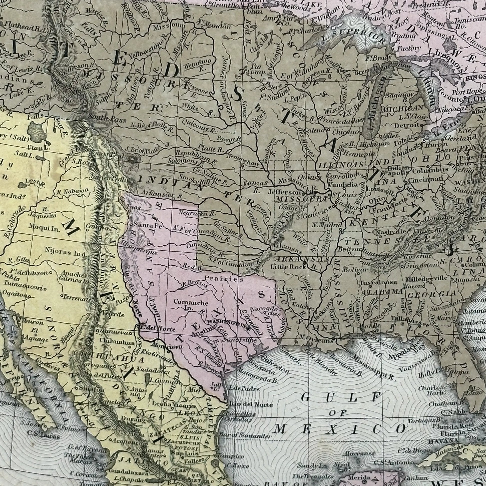
Look closely and you'll see the label “Prairies” near the Brasos and “Comanche In.” roughly where Abilene is today. Immediately north of the panhandle, “INDIAN TER”. West of Salt Lake, the large barren area is labeled “Sandy Plain," and the locations of some of the tribes in the West are identified.
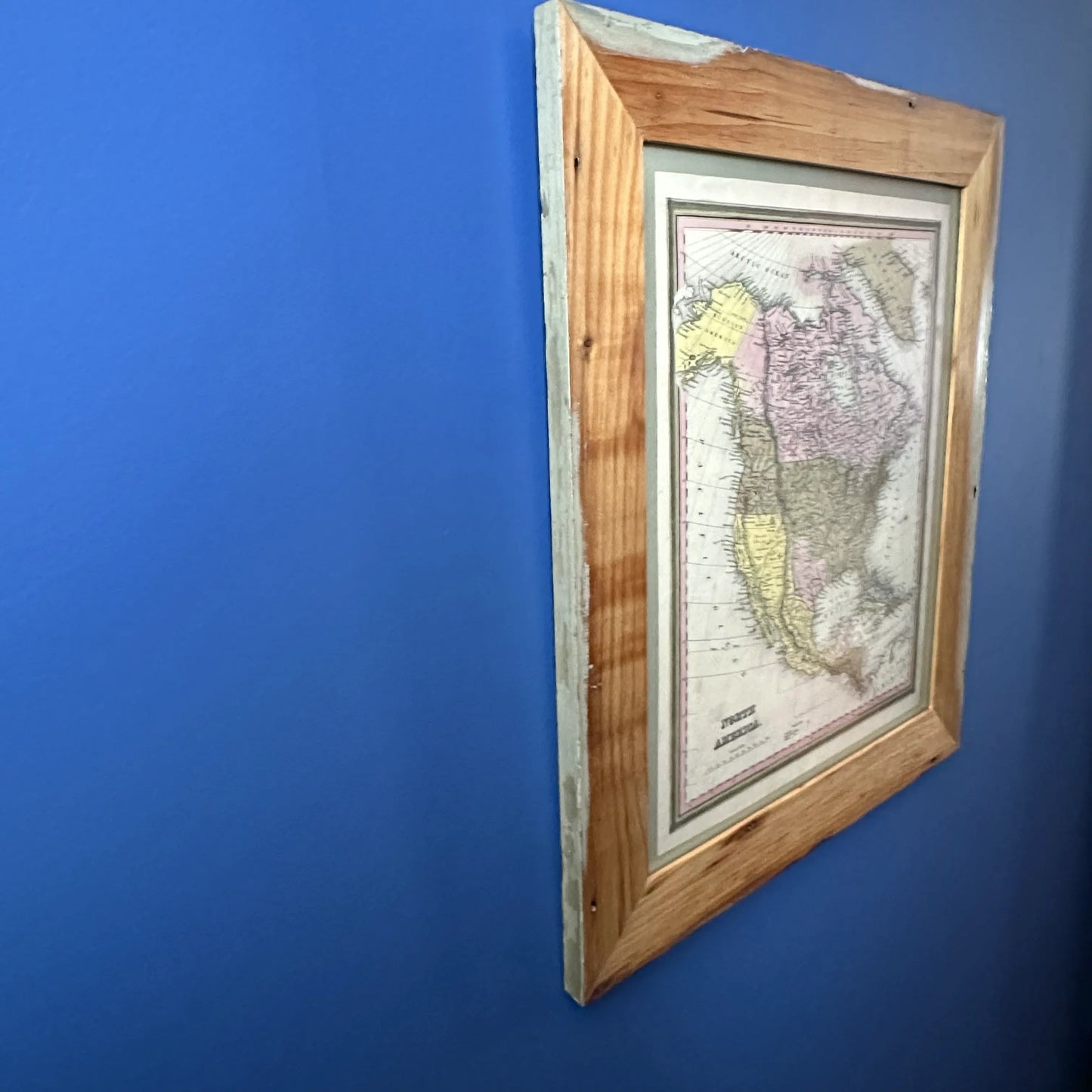
I made the frame from wood that was once in my house, and since my house dates to 1803, the wood might very well be as old as the print.
As you can see, I planed the boards and left the nail holes and some of the original light green paint on the front face. I left the edges untouched and applied several coats of a clear oil to protect and to show off the wood. The map is “floating” on a green mat so you see the entire sheet.
Many of the frames I make are black and when I use mats, they are usually white, but with the beautiful colors in the map, I thought this was a nice complement to the print.
Size of frame: 19" x 22"
Size of print: 12.5" x 15.25"
Only one.
Shipping: $25. Will be shipped UPS with a signature required.
Mission
Mission
Your purchases support our mission to engage people with local history and to support historic sites and history organizations across the country.